Mapping the World,
Building a Sustainable Future
Project Objective
The purpose of this project is to generate a 3D building information model (BIM) of the Engineering Laboratory (Building 17) at California State Polytechnic University, Pomona by creating a high-resolution digital surface model (DSM) and point cloud. The team will conduct field surveys and engineering studies to provide a precise rendering model. These tasks include, but are not limited, to defining the boundaries, researching engineering record, identifying the equipment and resources required, processing all and survey data, This project can be utilized for planning, design, construction, and maintenance. BIM offers real-time updates regarding infrastructure status to promote unity and synchronous knowledge for industries and professionals alike.
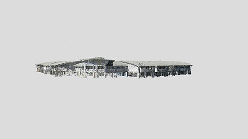
Point Cloud
A 3D point cloud was rendered and processed through Trimble Realworks. This model was used to create a Building Information Model (BIM) of the building. Some benefits of utilizing a point cloud are saving time out in the field, avoid the possibility of missing project scope features when collecting data, and produce topographic and structural features in the office.
The 3D point cloud of Building 17 was exported onto Sketchfab to allow users to view and observe the point cloud from any angle!